OlmoEarth Studio adds custom embedding export for Earth observation
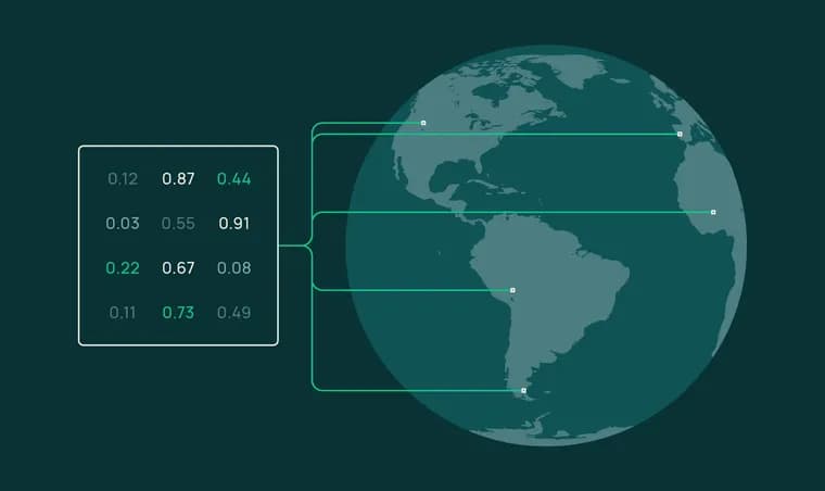
OlmoEarth Studio, a platform for building Earth observation models, now lets users compute and export embedding vectors: compact numerical representations of satellite imagery produced by the open source OlmoEarth foundation models. The source code, model weights and a research paper are all public, so the underlying method can be inspected directly. Custom-computed embeddings are now available to OlmoEarth Studio users; people interested in access are asked to reach out, and separate instructions let anyone use the public OlmoEarth models to compute their own embeddings without Studio.
In Studio, a user configures a model and runs it like any other prediction, then downloads the result. Five parameters control the output: area of interest (drawn or uploaded as a polygon), time span (1 to 12 monthly periods), encoder variant, spatial resolution (10, 20, 40 or 80 meters per pixel), and imagery source (Sentinel-2 L2A, Sentinel-1 RTC, or both). Three encoder variants are offered: Nano (128 dimensions, 1.4M parameters), Tiny (192 dimensions, 6.2M parameters) and Base (768 dimensions, 89M parameters). The output is a Cloud-Optimized GeoTIFF with one band per embedding dimension, stored as signed 8-bit integers ranging from -127 to +127, with -128 reserved for missing data; a function called dequantize_embeddings converts these back into floating-point vectors. Because embeddings are computed on demand rather than drawn from a pre-built global archive, they reflect the exact area, time window and imagery a user selects, including month-by-month embeddings that capture seasonal change rather than only annual snapshots.
The post walks through four uses, all built on OlmoEarth-v1-Tiny embeddings at 40-meter resolution with Sentinel-2 L2A imagery. In similarity search, a query pixel's embedding is compared by cosine similarity against every other pixel in a scene; around Merced, California, urban fabric and roads lit up coherently while cropland stayed dark, with no labels involved. In a second similarity-search example over an agricultural window, the most similar patches (cosine similarity 0.89 and above) were all irrigated farmland, while the least similar were an airport, a dry reservoir and arid rangeland. For few-shot segmentation, the authors labeled just 60 pixels (20 each for mangrove, water and other land cover, using ESA WorldCover 2021 as the label source) over Ca Mau, Vietnam, trained a logistic regression on top of the frozen embeddings, and produced a land-cover map across the whole region with a weighted F1 score of 0.84; accuracy barely changed when the label count was increased from 30 to 300, which the authors attribute to the embeddings already doing most of the work. For change detection, embeddings computed monthly for September 2023 and September 2024 over the same region were compared by per-pixel cosine distance, and the comparison immediately highlighted the Park Fire burn scar (July to September 2024) in Butte County, California. For unsupervised exploration, Principal Component Analysis reduced embeddings to three dimensions mapped to red, green and blue; over Flevoland, a reclaimed polder region in the Netherlands, the resulting false-color image reproduced the area's regular agricultural parcel grid and distinguished crop types, water and urban areas by color alone.
The post frames embeddings as a fast, lower-cost entry point compared with full fine-tuning: they work well in resource-constrained settings and are easy to share as lightweight COGs. For applications that need more accuracy, OlmoEarth Studio also supports supervised fine-tuning (SFT), training a task-specific model head on a user's own labels, which the authors say typically outperforms linear probes built on frozen embeddings. The post closes with a limitations note: users should check embedding quality for their own use case using the techniques it demonstrates, and performance depends on input imagery quality, since persistent cloud cover, atmospheric artifacts or missing observations in a composite period can affect the resulting vectors. Imagery credited in the post includes Sentinel-2 L2A from the European Space Agency via Microsoft Planetary Computer, and ESA WorldCover 2021 v200 as the mangrove reference layer; the global clustering visualization shown in the post used OlmoEarth-v1-Base (768-dim) over 1.1M pretraining samples, reduced to 15 k-means clusters.
Key facts
- OlmoEarth Studio now computes and exports embedding vectors from the open source OlmoEarth Earth observation models as Cloud-Optimized GeoTIFFs, with source code, model weights and a research paper public.
- Three encoder variants are offered: Nano (128-dim, 1.4M params), Tiny (192-dim, 6.2M params) and Base (768-dim, 89M params), with exports configurable to 10, 20, 40 or 80 meter resolution and 1 to 12 monthly periods using Sentinel-2 L2A and/or Sentinel-1 RTC imagery.
- A logistic regression trained on just 60 labeled pixels over Ca Mau, Vietnam produced a three-class land-cover map with a weighted F1 of 0.84, and accuracy barely changed between 30 and 300 labels.
- A change-detection example comparing September 2023 and September 2024 embeddings for the same region immediately highlighted the Park Fire burn scar in Butte County, California.
- Custom embedding exports are live now for OlmoEarth Studio users on request; embeddings are pitched as a cheaper entry point than fine-tuning, with Studio also offering supervised fine-tuning for higher accuracy.
Why it matters
Turning satellite imagery into a small, precomputed vector per location is what lets analysts run search, mapping and change-detection tasks with basic tools like a dot product or a logistic regression, instead of training or serving a full model. OlmoEarth Studio's export makes this workflow self-service: pick an area, a time window and an encoder, and get back a lightweight GeoTIFF that any geospatial tool can read.
Who it affects
Anyone building on Earth observation data with limited machine learning resources: land-cover and agriculture mapping, conservation and habitat monitoring, disaster response such as wildfire-scar detection, and urban or infrastructure analysis. It also affects existing OlmoEarth Studio users specifically, since custom embedding export is gated behind Studio access rather than being open to everyone by default.
How to use it
Inside Studio, a user configures a model like any other prediction run, choosing an area of interest, a time span of 1 to 12 monthly periods, an encoder variant (Nano, Tiny or Base), a spatial resolution of 10 to 80 meters, and Sentinel-2 and/or Sentinel-1 imagery, then downloads a Cloud-Optimized GeoTIFF with one band per embedding dimension. The exported int8 vectors (-127 to +127, -128 for nodata) can be dequantized to floating point and read with QGIS, GDAL, rasterio or custom scripts; a public tutorial and a Colab notebook reproduce the post's similarity-search, segmentation, change-detection and PCA examples. Custom exports require reaching out for Studio access, but the underlying OlmoEarth models and code are public, so embeddings can also be computed independently of Studio. For higher accuracy than a frozen-embedding linear probe, Studio supports supervised fine-tuning of a task-specific model head.
How solid is it
The demonstrated results are concrete and reproducible in the accompanying tutorial and notebook: a 0.84 weighted F1 from 60 labeled pixels, a clean burn-scar signal from a two-date comparison, and a PCA visualization that recovers a known agricultural grid in the Netherlands. The post also claims strong performance in the team's own benchmarking and in independent evaluations, but gives no numbers or methodology for either, and offers no numeric comparison against other Earth observation foundation models.
Risks and caveats
The post itself flags that embedding quality should be checked for each specific use case using techniques like the ones it demonstrates, and that performance depends on input imagery quality: persistent cloud cover, atmospheric artifacts or missing observations in a composite period can degrade the resulting vectors. Access to custom exports is by request only, with no pricing or access process described beyond asking to be reached out to, and the 'independent evaluations' the post cites are not described further.
“Because everything is computed on demand rather than pulled from a pre-computed global archive, your embeddings reflect exactly the conditions you care about.”
— OlmoEarth Studio blog post