TACLS pairs GNSS satellite data with machine learning to catch flash floods sooner
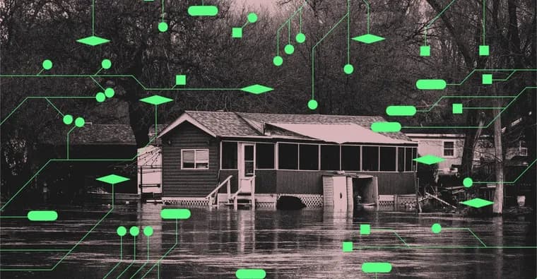
On June 9th, Laura Lin was on a Zoom call at her home in Lanesville, a rural Indiana town about 15 miles from the Kentucky border, when heavy rain started flooding her yard. Lanesville got over 8 inches of rain in just a few hours that day, far past the threshold the National Weather Service (NWS) calls heavy rainfall. Lin saw pieces of her wood barn floating past, grabbed her kids and fled to a neighbor's house; the water was gone within hours. 'We didn't get the get on your roof warnings until I was already at that person's house,' she says. 'All the people in town were already flooded when they started sending out alerts.'
Floods are the second deadliest type of weather event in the US and the deadliest worldwide. Just 6 inches of fast moving water can knock an adult off their feet, 12 inches can lift a car, and 2 feet can move a truck or SUV; the August flash flooding in Nepal caused by a glacier collapse is cited as an example of the damage water can do. A warming climate is producing more extreme rainfall, and with it more opportunities for floods.
A new system called TACLS, the Transient Artifact and Continuous Learning System, is meant to give forecasters more lead time before that happens. It was built by scientists from UC San Diego, the NWS and NASA, with NASA's Earth Science Technology Office funding the work through its Advanced Information Systems Technology program. Project lead Yehuda Bock, a research geodesist at UCSD's Scripps Institution of Oceanography, explains that TACLS runs on the Global Navigation Satellite System (GNSS), a network of satellites and ground sensors normally used to predict earthquakes. The more water vapor in the atmosphere, the longer the delay in communication between GNSS satellites and the ground sensors, and that delay reveals how much 'precipitable water' is building up in the sky, in real time, before a storm arrives.
UCSD graduate student Bhavik Chandna spent about a year building the machine learning side of TACLS, using a long short-term memory (LSTM) architecture, which he says works well for storms and other weather patterns that change over time. The model was trained on years of GNSS atmospheric measurements plus historical data on atmospheric rivers, precipitation and past flash flood warnings, so it learns how moisture shifts as a storm develops and helps judge when conditions call for a warning. To cut down on false positives, such as a single malfunctioning sensor, the system checks whether a signal shows up across several nearby GNSS stations rather than just one before treating it as a real atmospheric signal, Chandna says.
TACLS is already in use at the NWS forecast offices in Oxnard, California, which covers the LA area under senior service hydrologist Jayme Laber, and in San Diego under science and operations officer Ivory Small, both places where flash flooding is common. For now it only covers California. Today it shows forecasters a real time graph of conditions; a newer version with improved graphics, including a map of rainfall amounts and whether an extreme weather event is under way, is close to finished and will reach all NWS offices in the second half of October, Laber says. There are 122 NWS weather forecast offices across the US and its territories, and the plan is for all of them to eventually get TACLS.
Joel Johnson, an associate professor of earth and planetary sciences at the University of Texas at Austin who was not involved in the project, says machine learning 'sucks at some things and excels at some things' and that it is easy for data to carry artifacts or false positives, for example from a malfunctioning sensor. Even so, he calls TACLS 'well suited' to the task of predicting flash floods. Chandna is careful to note that TACLS is not meant to replace the forecasters who issue alerts, just to give them another piece of information for their decision.
Laber expects TACLS to see the most use in the western US, since most GNSS sensors sit in earthquake prone areas there, but Chandna thinks the same approach could work in other parts of the world as long as there are some GNSS sensors and local weather data available. Small says the NWS will keep learning from each storm to refine how it issues warnings. For Lin, back in Lanesville, the point is simpler: an alert telling her to get to higher ground before the water arrived, rather than after, would have made the difference.
Key facts
- TACLS pairs GNSS satellite data, normally used to predict earthquakes, with a long short-term memory machine learning model to read real time atmospheric moisture and give NWS forecasters more lead time before a flash flood.
- It was built by scientists from UC San Diego, NASA and the NWS, led by research geodesist Yehuda Bock, with funding from NASA's Earth Science Technology Office; the machine learning side took UCSD graduate student Bhavik Chandna about a year to develop.
- It is already running at the NWS forecast offices covering Los Angeles (Oxnard) and San Diego, currently limited to California; an improved-graphics version is set to reach all NWS offices in the second half of October.
- Floods are the deadliest weather event worldwide; 6 inches of fast water can knock an adult off their feet and 12 inches can lift a car. Lanesville, Indiana got over 8 inches of rain in a few hours on June 9, flooding resident Laura Lin's home before warnings reached her.
- Outside expert Joel Johnson calls TACLS 'well suited' to the task but notes machine learning is prone to false positives; developer Bhavik Chandna says the system cross-checks signals across multiple GNSS stations to filter those out, and stresses TACLS assists forecasters rather than replacing them.
Why it matters
Flash flood warnings today lean on rain and stream gauges plus forecasts that can lag the actual storm, and Laura Lin's account of alerts arriving only after her Indiana town had already flooded shows the cost of that lag. Floods kill more people worldwide than any other weather event, and the margins are small: 6 inches of fast water can knock someone off their feet, 12 inches can lift a car. TACLS targets that gap directly, reading atmospheric moisture from GNSS satellite signals in real time rather than waiting for rain to fall, which is meant to buy forecasters extra minutes or hours before conditions turn dangerous.
Who it affects
The immediate users are NWS forecasters, first at the Oxnard (Los Angeles area) and San Diego weather forecast offices, with a plan to extend TACLS to all 122 NWS forecast offices across the US and its territories. The people downstream of that decision are residents of flood prone areas; the story centers Laura Lin's household in rural Lanesville, Indiana, and notes flash flooding is especially frequent in the western US. Hydrologist Jayme Laber expects the West to see the heaviest use of TACLS because most GNSS sensors cluster in earthquake prone areas there, though developer Bhavik Chandna believes the same method could extend to other regions once GNSS sensors and local weather data are available.
How to use it
TACLS is not a public app; it is a decision support tool that sits alongside the rain gauges, stream gauges, satellites and radar that NWS staff already use, feeding them a real time picture of precipitable water to weigh against the forecast before they decide whether to issue a flood watch, advisory or warning. Today it shows a graph; a newer version with a detailed map of rainfall and extreme weather conditions is nearly finished and is due to reach every NWS office in the second half of October. For now it works only in California, where it has already been deployed in the Los Angeles and San Diego forecast offices.
How solid is it
The account comes from on the record interviews with the people who built and run TACLS: project lead Yehuda Bock, hydrologist Jayme Laber, science and operations officer Ivory Small, and developer Bhavik Chandna, plus an independent assessment from Joel Johnson, a University of Texas at Austin professor who had no role in the project. Johnson's endorsement is qualified rather than absolute, he calls TACLS 'well suited' to the task while flagging that machine learning generally is prone to artifacts and false positives. Chandna describes a specific mitigation the team built in: a signal only counts as a real atmospheric event once it shows up across multiple nearby GNSS stations, not just one.
Risks and caveats
The source gives no quantified figure for how much extra lead time TACLS actually buys forecasters, only qualitative claims that it helps. Machine learning systems in general are prone to false positives from bad sensor data, and the GNSS network is denser in earthquake prone parts of the western US than elsewhere, so coverage is uneven; the satellites the NWS relies on are also described as more detailed over oceans than land. TACLS is explicitly built to assist forecasters, not replace their judgment, and it is still limited to California while the wider NWS rollout is pending.
“It will help you save lives.”
— Ivory Small, science and operations officer, NWS San Diego Weather Forecast Office