Google DeepMind releases SatWeave and PARDIG weather datasets
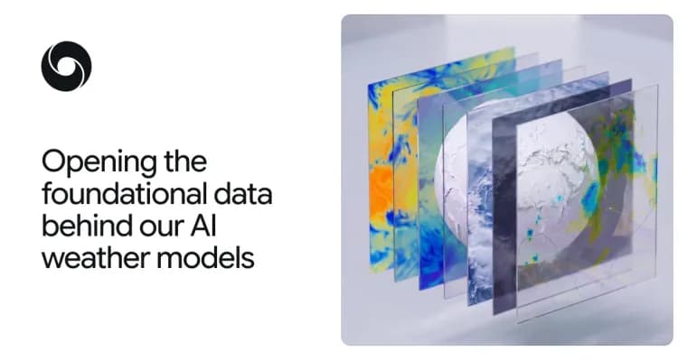
Google DeepMind has released two datasets, SatWeave and PARDIG, to help researchers and developers build weather, hydrology and climate applications. The company says both are key to the advances in its recently released WeatherNext 3 model. Each comes as a historical archive and a live feed.
SatWeave is a global mosaic of geostationary satellite imagery that gives the model a live view of developing clouds and storms. It combines imagery from five satellites covering different parts of the globe: GOES-East and GOES-West, Meteosat 0 and Meteosat Indian Ocean, and Himawari. Each uses different map projections, file formats, sensors and scan schedules (ranging from 10 to 30 minutes), which makes a coherent global map hard to build. According to DeepMind, most existing global composites drop the incompatible aspects, offering only four or fewer channels or updating every few hours. SatWeave updates hourly. DeepMind says this lets WeatherNext 3 produce new global predictions every hour, in contrast to models initialized on analysis data refreshed every six hours. The hourly live feed is being released along with a historical archive spanning over a decade. DeepMind used SatWeave in WeatherNext 3's medium-range forecasts and says it would like to explore solar power and wildfire monitoring with the wider research and developer community.
PARDIG (Precipitation AI Reanalysis: Densely Inferred GPM) is an AI-based global precipitation dataset that was used to train WeatherNext 3's precipitation forecasts. It is built on an AI architecture similar to WeatherNext 3 and trained directly on sparse spaceborne radar observations from the NASA Global Precipitation Measurement (GPM) Core Observatory. Its inputs are SatWeave imagery and atmospheric fields from ECMWF. The result is a global precipitation map at 15-minute temporal resolution and roughly 10-kilometer resolution, updated with an average latency of about five hours. Ground radars and dense rain gauge networks give high-quality data, DeepMind notes, but they are not available or well covered everywhere, and PARDIG is meant to help bridge that gap.
DeepMind evaluated PARDIG against three continental radar networks across the US, Europe and Japan, and against over 36,000 weather stations worldwide. It reports that PARDIG outperforms leading global baselines across all analyzed rain rates, including NASA's IMERG-Final, a research-quality precipitation dataset. On light-to-moderate precipitation, PARDIG improves hourly precipitation detection skill over IMERG-Final by more than 30%. The post adds that PARDIG proved particularly effective at capturing extreme precipitation, which existing global products can struggle to detect. Because it learns directly from satellites rather than relying only on ground measurements, DeepMind says it expects reliable accuracy everywhere on Earth, even where ground measurements are unavailable.
PARDIG historical archives cover 1999 to 2026, alongside the live feed. DeepMind says it would like to work with the community on improved models for floods, landslides and drought, especially in regions without dense ground radar networks.
The SatWeave and PARDIG live and historical datasets are openly available on Google Cloud Storage. PARDIG's historical catalogs are also available in Google Earth Engine. DeepMind calls the release the latest addition to Google's Earth AI portfolio. The work was developed by teams across Google DeepMind and Google Research, in collaboration with Google Cloud and Google Geo, and the post thanks the organizations behind the open satellite programs and datasets it relies on, including ECMWF, NASA, JAXA, NOAA, EUMETSAT, KMA, JMA, KNMI and Synoptic Data.
Key facts
- SatWeave combines imagery from five geostationary satellites (GOES-East, GOES-West, Meteosat 0, Meteosat Indian Ocean, Himawari) into one global mosaic that updates hourly, with a historical archive spanning over a decade.
- PARDIG is an AI-based global precipitation map at 15-minute temporal and roughly 10-kilometer resolution, with an average latency of about five hours and historical archives from 1999 to 2026.
- DeepMind reports PARDIG beats NASA's IMERG-Final on all analyzed rain rates and improves hourly precipitation detection skill by more than 30% on light-to-moderate precipitation; this is its own evaluation against three radar networks and over 36,000 weather stations.
- Both datasets were used in WeatherNext 3: SatWeave for medium-range forecasts and PARDIG to train its precipitation forecasts.
- Live and historical data are openly available on Google Cloud Storage; PARDIG's historical catalogs are also in Google Earth Engine.
Why it matters
Forecasting starts with how quickly and coherently the planet can be observed. DeepMind frames the problem as turning raw satellite and ground measurements into a global picture and delivering it fast. SatWeave addresses the first half by unifying five satellites with different projections, formats, sensors and scan schedules into one hourly mosaic. DeepMind contrasts that with models initialized on analysis data refreshed every six hours. PARDIG addresses precipitation in places lacking ground radar or dense rain gauges. Releasing the data behind WeatherNext 3 gives outside teams the same inputs the company used for its own model.
Who it affects
The post targets researchers and developers building weather, hydrology and climate applications. DeepMind names possible follow-on uses it hopes to explore with the community: solar power and wildfire monitoring for SatWeave, and floods, landslides and drought for PARDIG, especially in regions without dense ground radar networks. These are stated intentions, not results.
How to use it
The SatWeave and PARDIG live and historical datasets are openly available on Google Cloud Storage. PARDIG's historical catalogs are also available in Google Earth Engine. Each dataset has a historical archive (SatWeave over a decade, PARDIG 1999 to 2026) and a live feed (SatWeave hourly, PARDIG with an average latency of about five hours). The post gives no license terms beyond "openly available", and no data volume, file format or access cost.
How solid is it
This is a first-party release from Google DeepMind, and the evaluation figures are its own. It compared PARDIG with three continental radar networks across the US, Europe and Japan and with over 36,000 weather stations worldwide. The post does not name the metric behind the more than 30% gain over IMERG-Final, or say whether the gain is relative or in percentage points. It gives no numbers for extreme precipitation or for baselines other than IMERG-Final. No independent evaluation or outside reaction is reported, and no numeric WeatherNext 3 forecast skill figures are given.
Risks and caveats
The claim that PARDIG should have reliable accuracy everywhere on Earth, even where ground measurements are unavailable, is an expectation stated by DeepMind, not a demonstrated result. PARDIG is trained on sparse spaceborne radar observations from NASA's GPM Core Observatory, with SatWeave imagery and ECMWF atmospheric fields as inputs, so it depends on those upstream sources. Its roughly 10-kilometer resolution and average latency of about five hours set the limits for applications that need finer or faster data. Only the post's own evaluation backs the performance claims so far.
“SatWeave is a global mosaic of geostationary satellite imagery that provides the model a live view of developing clouds and storms.”
— Google DeepMind blog post